Geolocating Field Units
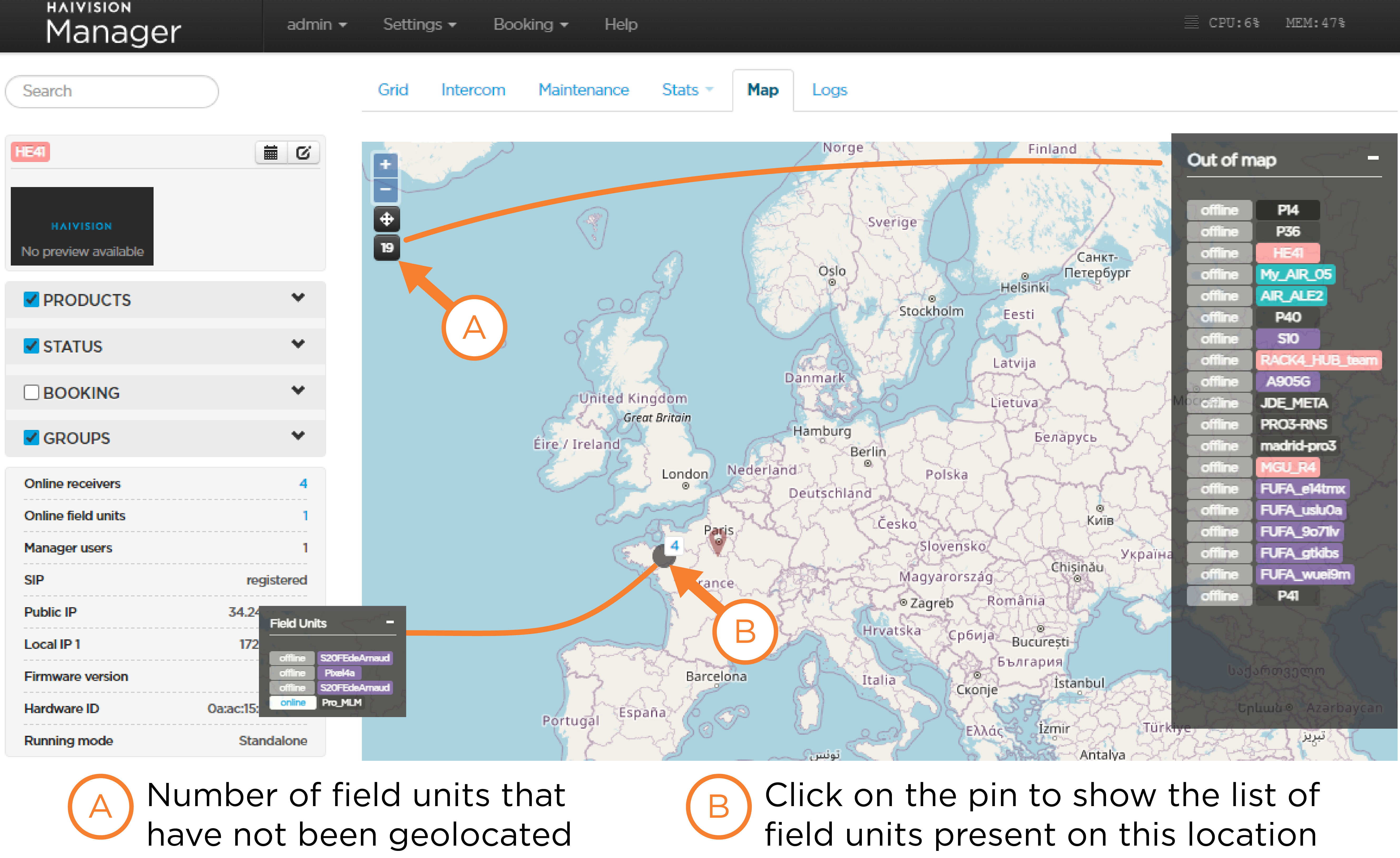
Under the Map tab, you can display any online or offline field unit on which the geolocation option is activated and has a valid location.
If several field units are very close, one pin indicates the number of field units.

You can click on the number list them.
For offline field units that have been previously geolocated and on which the geolocation is enabled, the last position is kept so that they are still shown on the map, represented by grey pins.
If needed, you can click the pin to show the field unit panel and reset the position of a field unit by clicking the 
